
October 2026
Overview
- What? A multi-level defensive settlement and refuge carved into volcanic tuff (a soft, easily workable rock formed from the compaction of volcanic ash and gases), designed for thousands of people to inhabit over extended periods [1].
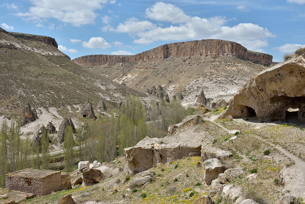
- Where? Located in the Central Anatolia Region, along the highway between Nevşehir and Niğde, at the center of the Derinkuyu district [1].
- Why is it important? With a capacity to shelter approximately twenty thousand people and an advanced ventilation system (ducts and shafts facilitating the circulation of fresh air), it is the largest subterranean city yet unearthed in Turkey [2].
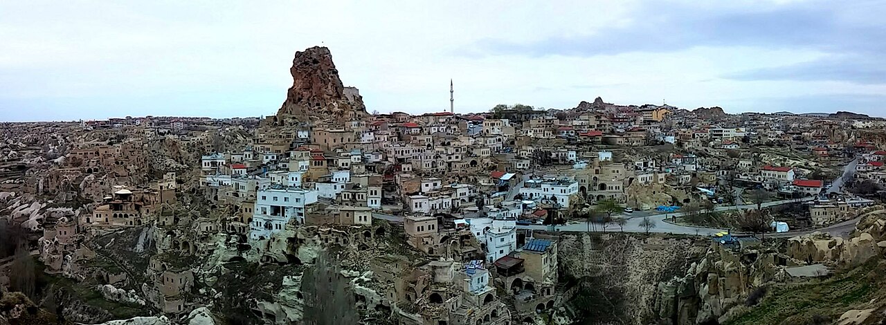
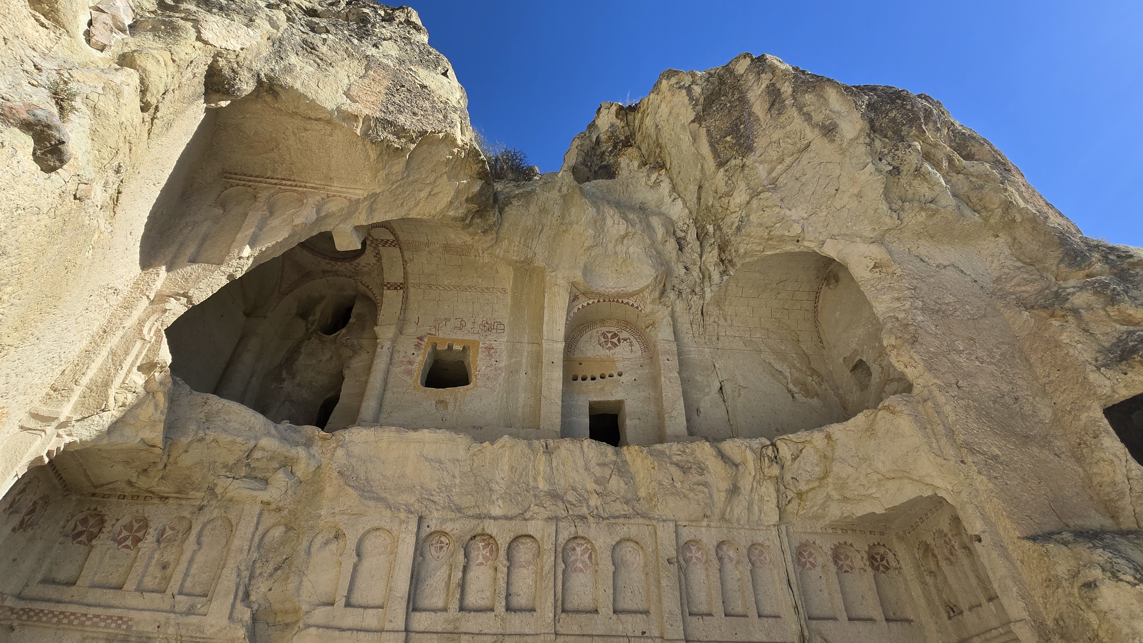
Within the earth’s crust of the Cappadocia region lie extraordinary defensive and residential spaces carved into the living rock by past civilizations [1]. Today operating with museum status, these sites demonstrate how human communities retreated underground during times of peril [1].
Derinkuyu stands out for its multi-tiered structure extending meters beneath the ordinary village fabric on the surface [2]. Research reveals that this refuge provided not merely a temporary hiding place, but a fully functional social order [1].
The soft volcanic tuff strata of the region were painstakingly excavated by ancient peoples and transformed into a monumental subterranean hub [2]. This ancient refuge system continues to command keen interest today across the fields of both architecture and archaeology [4].
Where is it?
Derinkuyu Underground City is located within the borders of Turkey’s Central Anatolia Region, in the district of Derinkuyu affiliated with Nevşehir Province [1]. The settlement lies along the highway connecting the provinces of Nevşehir and Niğde [1].
The road distance from the site to the Nevşehir city center is cited in sources as approximately thirty kilometers [1]. Its geographical coordinates are specified in Turkish sources as 38° 22′ 53″ N and 34° 44′ 10″ E [1]. In English sources, they are given as 38° 22′ 25″ N and 34° 44′ 06″ E [2].
The site covers a surface extent of approximately four square kilometers (one and a half square miles) [1].
This historical site lies within the boundaries of “Göreme National Park and the Rock Sites of Cappadocia,” inscribed on the UNESCO World Heritage List [2]. The area was registered in 1985 as a mixed heritage property, satisfying both cultural and natural criteria [2].
The name of the settlement derives from the deep well shafts (deep cavities) that supplied water to the people sheltered below as well as to villagers on the surface [2]. In Cappadocian Greek, the complex is known as Malakopia (soft, easily workable stone) [2]. In Turkish records, this name also appears as Melagobia or Melegobi [2].
Furthermore, an eight- to nine-kilometer tunnel exists between Derinkuyu and another underground city, Kaymaklı [2].
History & Origins
Sources diverge regarding the precise construction date of Derinkuyu Underground City and who first excavated the subterranean settlement [1]. Turkish sources state that the exact date remains unknown, though the city saw use during the Proto-Hittite, Hittite, Roman, and Byzantine eras [1].
English sources, on the other hand, indicate that the earliest rock-cut tunnels and chambers were hollowed out by the Phrygians (a people who inhabited Anatolia in the 7th–6th centuries BCE) during the eighth to seventh centuries BCE [2]. A marble eagle statue discovered in the city clearly demonstrates Roman influence, while its missionary school and church complexes exhibit evident Byzantine presence [1].
In the second century CE, early Christians fleeing Roman persecution arrived in Cappadocia via Antioch and Caesarea (Kayseri), expanding existing caves to lay the foundations of multi-tiered subterranean cities [1].
Communities that excavated deeper into the complex during the Late Roman Empire added chapels (small prayer rooms) and Greek inscriptions to the chambers [2]. Under the Byzantine Empire, the city took on a more systematic organization in terms of defensive architecture [2].
Derinkuyu was substantially expanded during the Arab–Byzantine wars between roughly 780 and 1180 to withstand Umayyad and Abbasid (two major dynasties of the Islamic world) raids [2]. During this prolonged period of conflict, the local Christian population took refuge underground, shielding themselves from incursions for extended stretches of time [2].
The city’s sheltering capacity of twenty thousand was approached most closely during these wartime periods [2]. The defensive layout encompassed not only concealment, but also the internal isolation of distinct sectors and the execution of planned counterattacks when necessary [2].
The underground cities also served as havens during the Seljuk conquests in the 11th century and the raids of Timur in the 14th century [2]. During peacetime, the Christian populace returned to the surface to engage in agriculture, retreating subterranean once more whenever danger resurfaced [2].
In the early 20th century, Cappadocian Greeks and Armenians sought refuge in the underground complex to protect themselves against waves of persecution and violence [2]. Cambridge University linguist Richard MacGillivray Dawkins recorded that the local population descended into these shelters during the 1909 Adana massacres [2].
Having maintained its function as a sanctuary across many centuries, Derinkuyu was completely abandoned following the 1924 population exchange (the compulsory exchange of populations between Turkey and Greece) [2]. It was rediscovered by chance in 1963 and opened to visitors in 1967 following clearance work [1].
Architectural Form
Layout and Core Units
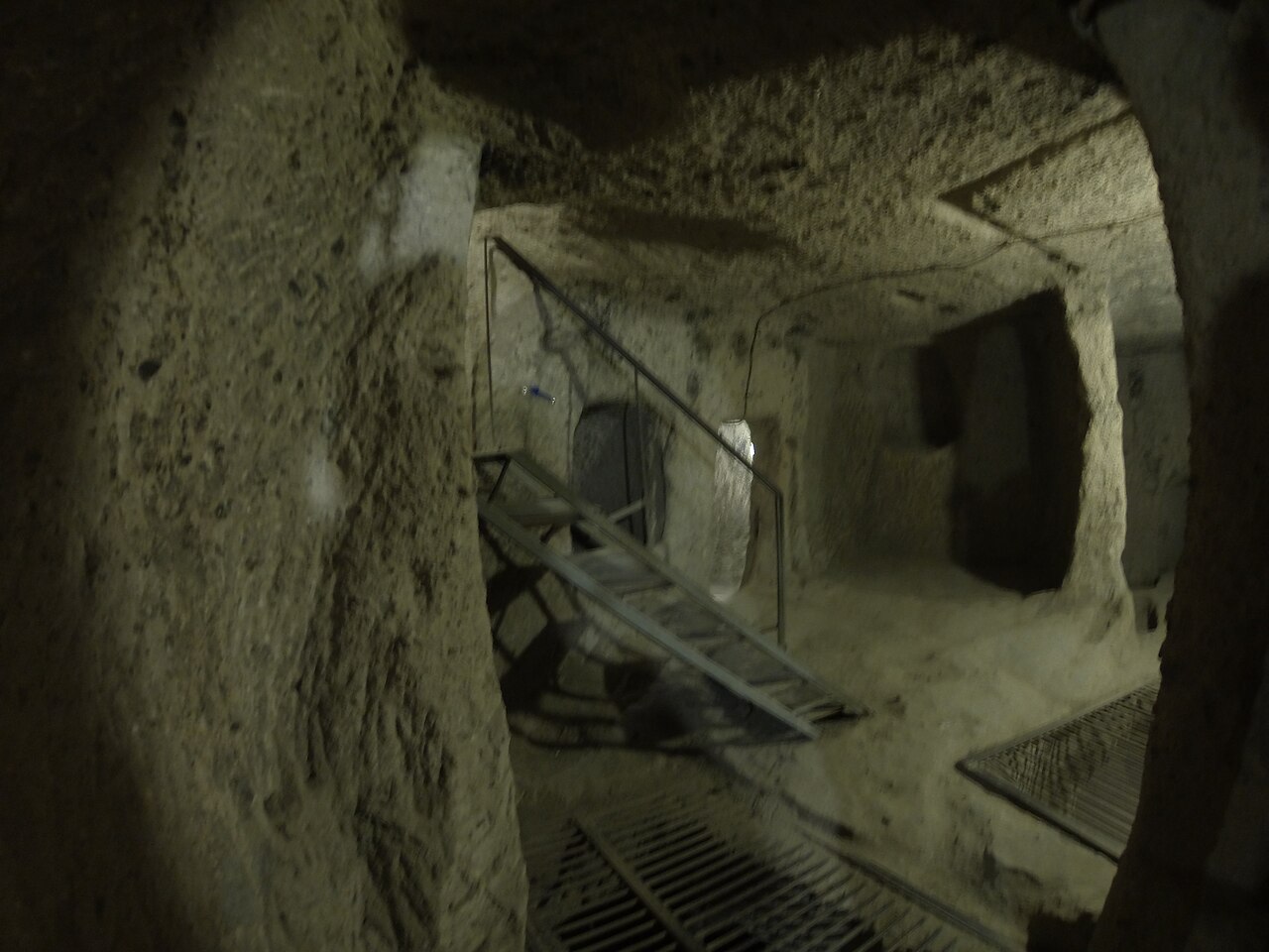
Derinkuyu was carved into soft rocks known as tuff, formed through the consolidation of volcanic ash and gases [2]. The overall depth of the complex can reach 85 meters, and the structure is reported to consist of 13 levels [1].
Currently, only 8 levels have been cleared and made accessible to visitors, reaching a depth of approximately 50 meters [1]. Should all levels be cleared, the total depth is projected to reach 85 meters, with the number of stories rising to 12 or 13 [1].
The underground city presents an architectural program capable of accommodating approximately 20,000 people simultaneously, alongside their livestock and provisions [2]. Levels and chambers are interconnected via narrow passageways and sloping corridors [1].
These tunnels feature large, round stone wheel doors shaped like millstones that could be rolled shut from the inside in moments of danger [1]. Thanks to these stone rolling doors, each level could be independently sealed, barring entry from outside [2].
To sustain long-term habitation, stables, food stores, pantries, wine cellars, and linseed oil presses (wool processing and oil production chambers) were carved out [2]. Kitchen areas incorporated tandoors (tandır, traditional earthen ovens) that remain in use in Cappadocian villages today [2].
Communal dining halls and chapels (small church chambers) for worship are also present. On the second level lies a spacious hall cut with a barrel vault (an arched ceiling contour extending in a semi-cylindrical form) unique to Derinkuyu [2]. Upon encountering the term barrel vault, one may envision an arched ceiling resembling the interior of a barrel or cradle, shaped like a continuous semi-cylinder.
This vaulted hall functioned as a missionary school (a Christian educational institution), with the smaller chambers to its left serving as study rooms [2].
Staircases between the third and fourth levels lead down to the church located on the fifth level—the lowest accessible tier [2]. Relics unearthed in the city, such as the marble eagle sculpture, illustrate that the space was endowed with diverse cultural imprints across different eras [1].
Ventilation System and Water Wells
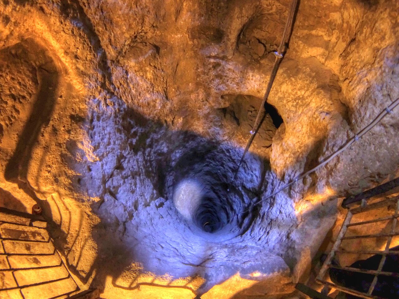
One of Derinkuyu’s most striking features is its vertical ventilation shafts (air flues extending up and down) that ensure an uninterrupted supply of fresh air across the deep subterranean floors [2]. In addition to the smaller air ducts interconnecting individual living chambers, the complex incorporates broad primary shafts [2].
One of the main shafts, plunging to a depth of roughly 55 meters, also served as a deep water well (a shaft supplying potable water); this well met the freshwater needs of surface villagers and underground occupants alike [2].
The base dimensions of the central main ventilation shaft measure approximately 3 m × 2.8 m [2]. Within this shaft, window apertures (vents admitting air) serving different levels never overlap vertically, allowing airflow to be regulated independently for each story [2].
This engineering layout was deliberately devised to maximize subterranean natural draft [2]. Consequently, even in the church and shelter quarters on the lowest levels, occupants were able to live for months on end without experiencing oxygen deprivation [2].
Acoustics and Spatial Organization
Derinkuyu is notable not only for its architectural layout, but also for its acoustic (sound-related) qualities [3]. A study published in 2025 examined the acoustics of three distinct interior typologies (the classification of rooms according to their functional purpose) within the eight-level complex [3].
The study emphasized sound as a fundamental element defining the identity of a space and measured reverberation time (the time required for acoustic energy to dissipate within an enclosed room after the sound source has ceased) [3]. Reverberation times varied according to room function; for instance, sound reverberated longer in large halls, whereas it decayed more rapidly in narrow corridors [3].
Spatial volume (the amount of enclosed space within a room) and historical patterns of use (such as worship, storage, or lodging) directly govern auditory perception; hence, the structure warrants conservation as an auditory heritage site [3].
Another study conducted in 2024 investigated Derinkuyu’s tiered architecture using space syntax methodology [4]. Space syntax is a modern analytical technique that mathematically maps configuration and accessibility relationships between spaces. Utilizing cross-sections and plan drawings obtained from archaeological excavations, researchers generated two-dimensional topological graph models using the software program Syntactic (a tool for analyzing spatial configurations) [4].
This study explored what spatial configuration would emerge if the subterranean tiered settlement were mapped across a single horizontal plane (i.e., at the same level) with identical nodal connections [4]. Consequently, it was noted that the portions uncovered to date constitute only a fraction of the actual city [4].
Visiting Notes
Derinkuyu Underground City is currently open to visitors as a museum under the supervision of the Republic of Turkey Ministry of Culture and Tourism [1]. Of the underground city’s 13 levels, only 8 levels have been cleared to date [1].
Visitors can descend to a depth of approximately 50 meters according to official sources [1]. Official sources project that as clearance operations advance, the accessible depth will eventually reach 85 meters [1].
Current museum opening hours, admission fees, Museum Pass validity, and discounted ticket conditions are not specified in the source texts. Timetables and route directions for public transportation vehicles providing access to the city
References
- [1] “Derinkuyu Yeraltı Şehri - Vikipedi”, https://tr.wikipedia.org/wiki/Derinkuyu_Yeralt%C4%B1_%C5%9Eehri
- [2] “Derinkuyu underground city - Wikipedia”, https://en.wikipedia.org/wiki/Derinkuyu_underground_city
- [3] “ANTİK BİR YERALTI ŞEHRİNDE AKUSTİK VE İŞİTSEL DENEYİM: DERİNKUYU YERALTI ŞEHRİ — Sezin NAS, Saadet Aytıs, Konca Şaher (2025, Nişantaşı üniversitesi sosyal bi”, https://dergipark.org.tr/tr/download/article-file/5158056
- [4] “Space Syntax Study for Underground City Example: Derinkuyu — Kubra Yilmaz Senel (2024, Journal of Turkish Studies)”, https://doi.org/10.7827/turkishstudies.75098
Konum
Harita: © OpenStreetMap katkıcıları. Haritada büyüt · Google Haritalar · Apple Haritalar
İşaret yaklaşık konumu gösterir; kesin konum için yerel kaynaklara bakın.
This article is compiled from scholarly monographs and official architectural inventories. Please verify site access conditions, visiting hours, and ongoing conservation status via official heritage authorities prior to visiting.