
October 2026
Overview
- What: An expansive eight-story subterranean settlement carved into soft volcanic tuff [1].
- Where: Located in the town of Kaymaklı, approximately nineteen kilometers from the provincial center of Nevşehir [1].
- Why it matters: It provided safe shelter and an emergency defense sanctuary for diverse communities over thousands of years [2].
Introduction
Kaymaklı Underground City ranks among the most renowned examples of multi-tiered subterranean refuge complexes in the Cappadocia region [1]. Situated along the Nevşehir–Niğde road, the settlement preserves millennia-old defensive underground architecture into the present day [1]. Carved out of soft volcanic tuff strata, this center met the need for temporary asylum during times of crisis [1].
Today, this subterranean settlement is intricately intertwined with the network of tunnels underlying the village houses on the surface [2]. According to sources, many of the modern town residences were constructed around roughly one hundred underground tunnel passages [2]. The local villagers continue to utilize these tunnels as cellars, storage spaces, and stables [2].
Throughout history, raids and warfare compelled the local population to retreat underground for safety [1]. Kaymaklı is a defensive center equipped with extensive facilities capable of sustaining hundreds of people for extended periods without surfacing [1]. Vast provisions stores, places of worship, and production workshops demonstrate that this subterranean world could fulfill all daily necessities [1].
Where is it?
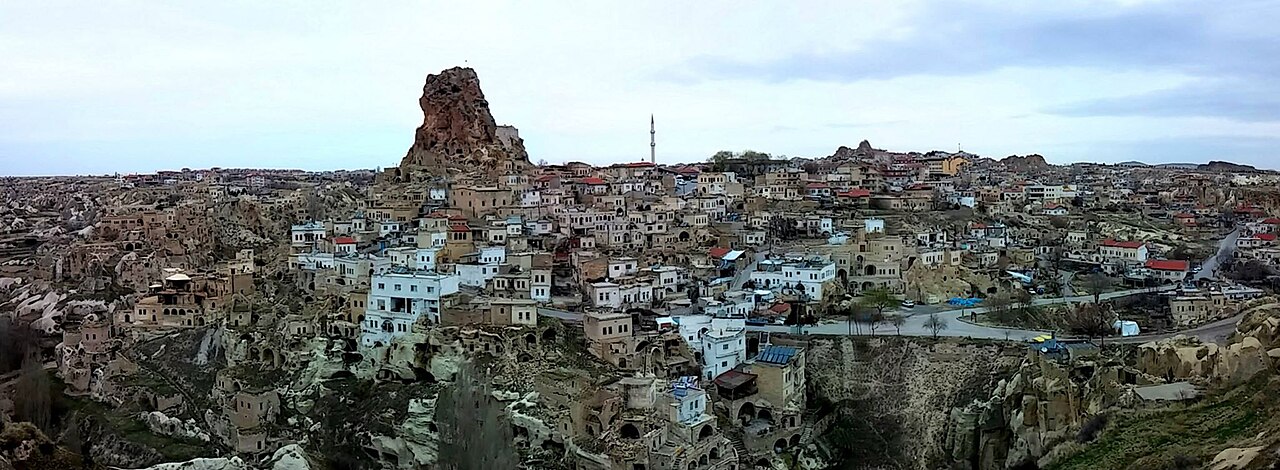
Kaymaklı Underground City is situated in the town of Kaymaklı, within the Central district of Nevşehir Province in the Central Anatolia Region [1]. The settlement’s geographic coordinates are thirty-eight degrees twenty-seven minutes north and thirty-four degrees forty-five minutes east [2]. The underground city complex is located directly within the bounds of the citadel or fortress elevation in the center of the town of Kaymaklı [2].
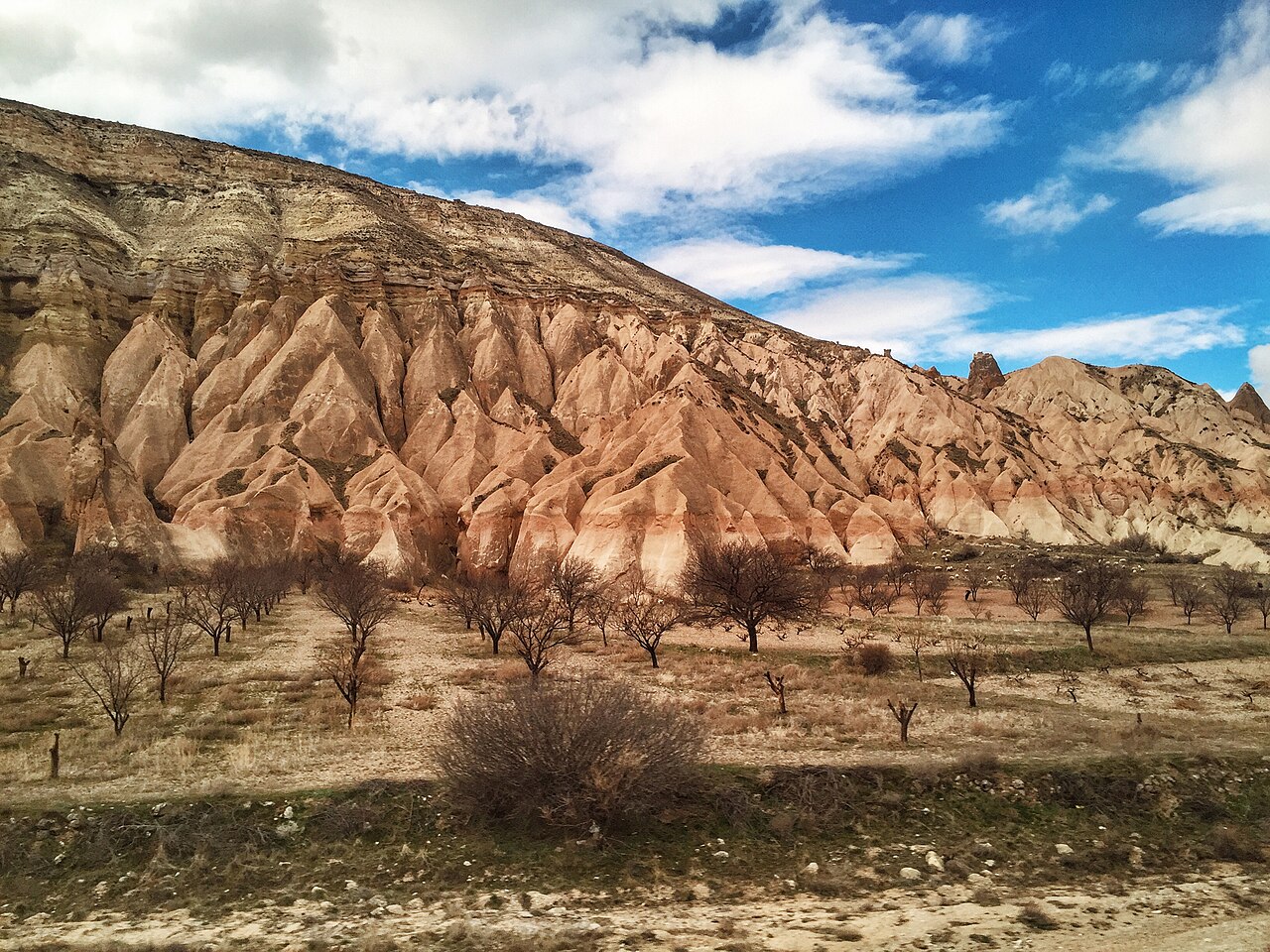
This historic site lies approximately nineteen kilometers from the city center of Nevşehir, along the route of the Nevşehir–Niğde highway [1]. The soft volcanic tuff rocks that define the region’s geological structure provided an ideal medium for carving out the settlement with ease [1]. The underground city is regarded as one of the largest refuge networks established across Cappadocia’s vast volcanic terrain [1].
The subterranean tunnels of the settlement are also notable for their spatial connections to other major surrounding centers [2]. According to sources, Kaymaklı Underground City connects to Derinkuyu Underground City via tunnels eight to nine kilometers in length [2]. With only certain sections uncovered today, the structure occupies an expansive area beneath the bedrock of the town [2].
The townspeople have integrated the entrances of approximately one hundred subterranean tunnels directly into their everyday living spaces [2]. The near-surface chambers of the underground shelters continue to be actively utilized by local residents for traditional storage functions [2]. This clearly demonstrates how an engineering achievement inherited from antiquity has become seamless with the modern rural fabric [2].
History & Origins
Historical sources and scholarly research present differing perspectives and chronologies regarding the foundation period of Kaymaklı Underground City [1]. According to the records of the Ministry of Culture of the Republic of Turkey, the settlement may have been initiated by the Phrygians in the eighth and seventh centuries BC [2]. The Phrygians were a civilization that ruled over Anatolia beginning in the 8th century BC, and were instrumental in the construction of subterranean shelters during this era [1].
In contrast, certain sources state that the initial construction of the city took place during the era of the Hittites and dates back to the seventh century BC [1]. The Hittites were a civilization that ruled over much of Anatolia from the 12th century BC onward; it is stated that cultural traces belonging to the shelters originate from this period [1].
It is reported that cultural traces belonging to ancient civilizations such as the Hittites, Phrygians, and Assyrians are present in the region’s subterranean structures [1]. The Assyrians were a civilization that ruled parts of Anatolia starting from the 9th century BC; regarding their connection to this historic site, cultural traces belonging to the shelters are known to exist [1].
With the settlement of Greek colonists in the region, the Phrygian language gradually vanished during the Roman period and gave way to Greek [2]. During subsequent periods of Roman and Byzantine rule, the city complex was deepened and considerably expanded through the excavation of new chambers [1].
Another source traces the origins of Kaymaklı to the eighth century AD, when Christians established refuges against invaders [2]. During the Eastern Roman era, the city was expanded to provide protection against Muslim Arab incursions throughout the Arab–Byzantine wars, which spanned four centuries [2]. Some archaeological artifacts recovered from the subterranean settlement also date between the fifth and tenth centuries, corresponding to the Middle Byzantine Period [2].
The Middle Byzantine Period spanned from the 5th century to the late 14th century in the Christian world; during this era, the shelters were enlarged and utilized for protection against Arab invasions [2].
These shelters were used for protection by the local Christian population during the fourteenth-century Mongol invasions led by the armies of Timur [2]. Following the transition of the region to Persianate Seljuk Turkish rule, the subterranean structures continued to serve as a refuge for the Greek community [2]. Under Ottoman governance, the Greek community retreated into these chambers during periodic episodes of oppression until the early twentieth century [2].
Cambridge University linguist Richard MacGillivray Dawkins recorded significant observations while conducting research on the Cappadocian Greeks of the region between 1909 and 1911 [2]. Dawkins noted that following the 1909 Adana events, the people of Axo sought refuge in these subterranean chambers and did not sleep above ground for days [2]. The underground city tunnels were abandoned entirely following the 1923 population exchange between Turkey and Greece [2].
The name of the settlement has been recorded in diverse forms across historical sources, witnessing numerous cultural transformations [1]. Known in Cappadocian Greek as Anaku or Enegüp, the settlement also appears under these names in Ottoman-era records [1]. Long referred to by locals as Eneği, the township was officially named Kaymaklı during the Republican era [1].
Architectural Form
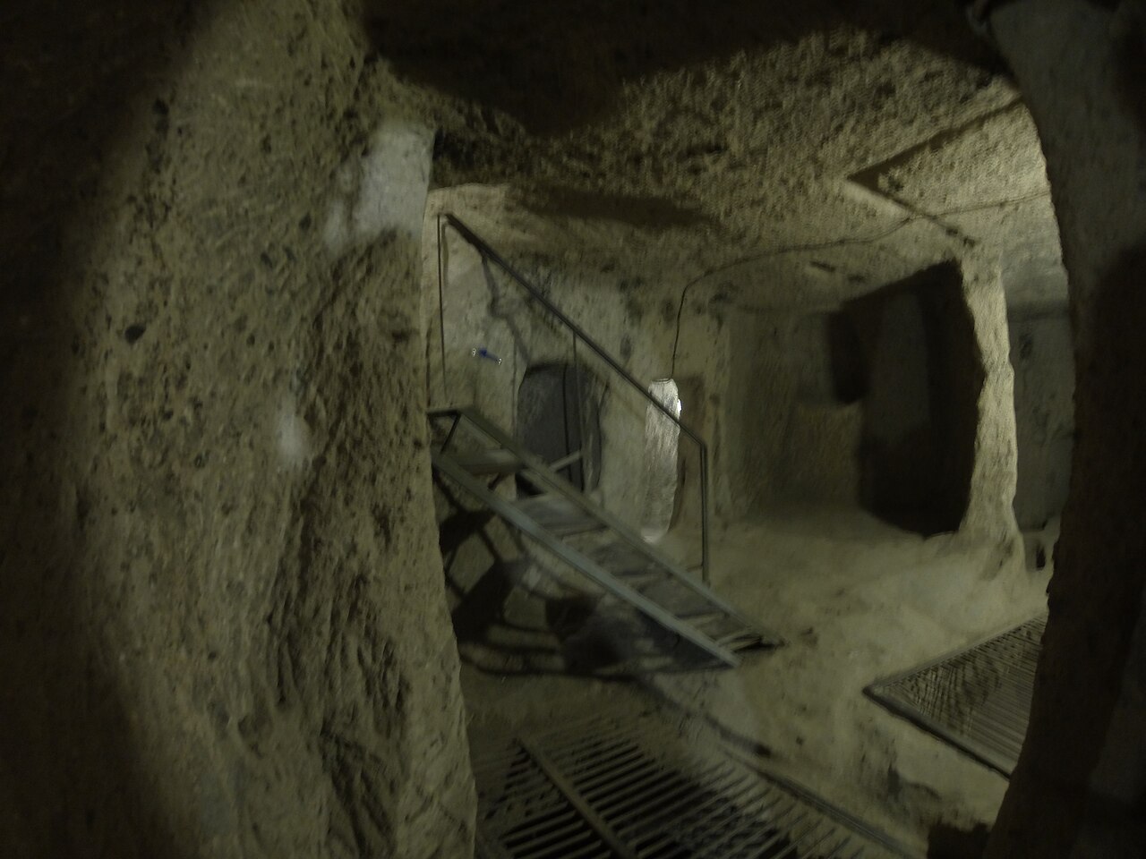
Kaymaklı Underground City is a multi-story complex comprising labyrinthine tunnels, spacious halls, cellars, and places of worship [1]. Of these shelters, which encompass a total of eight levels, only the four illuminated floors are open to visitors today [1]. With its sloping and exceptionally narrow passageways, the city exhibits marked architectural distinctions from its neighbor in Cappadocia, Derinkuyu [2].
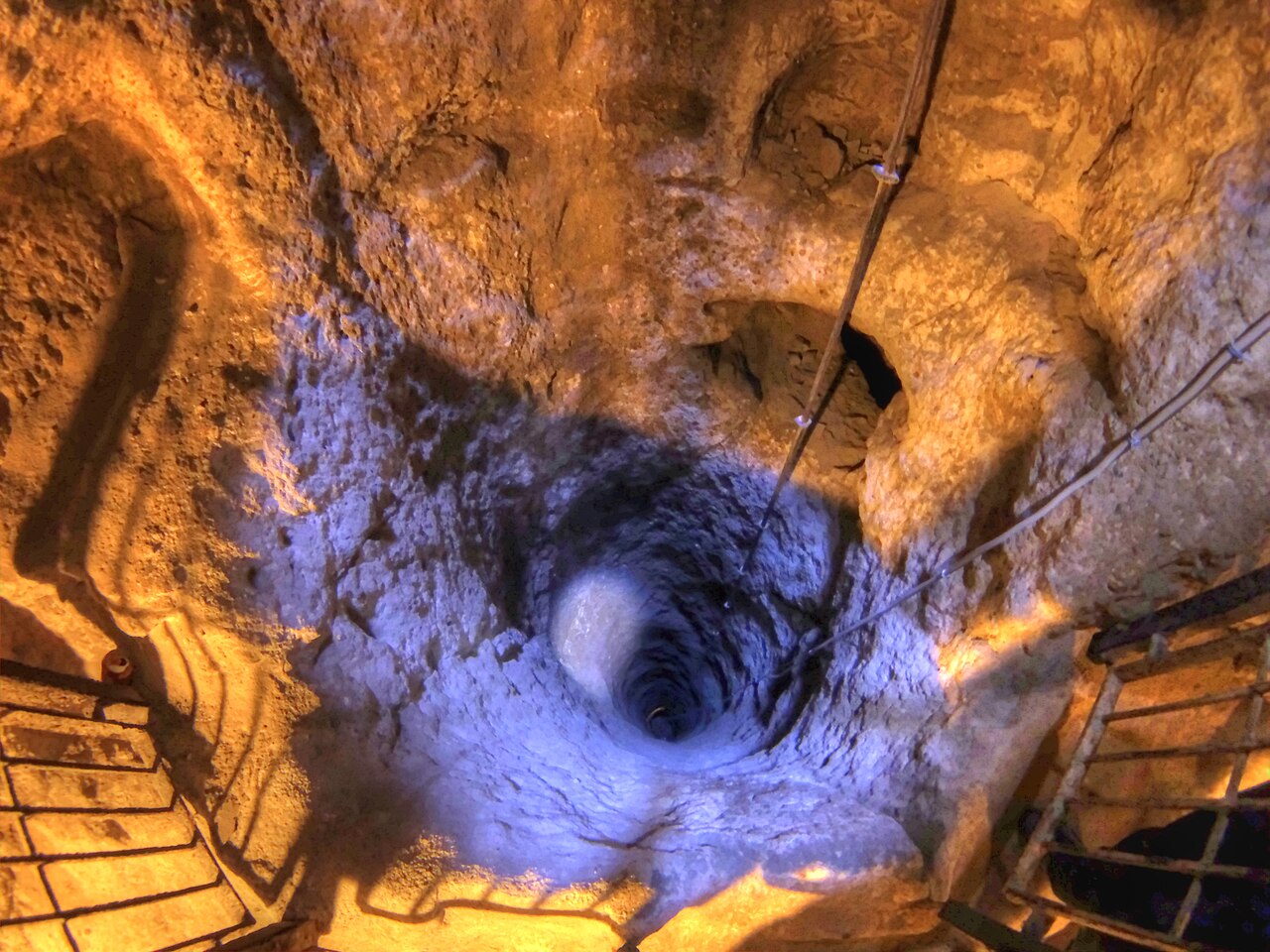
All rooms and galleries throughout the complex were organized around vertical shafts excavated for ventilation and communication [1]. The layout of each floor and functional space was designed according to its proximity to these shafts that supplied fresh air [2]. The water wells within the underground city were constructed without direct access to the surface to mitigate the risk of enemies poisoning the water supply [1].
The first floor open to visitors contains spacious living chambers as well as a small-scale animal stable [1]. Because it was difficult to transport cattle and small livestock to lower levels, the stable was situated on the entrance level [1]. To the left of the stable lies a passageway with a millstone-like rolling stone door, while living rooms are situated to the right [2].
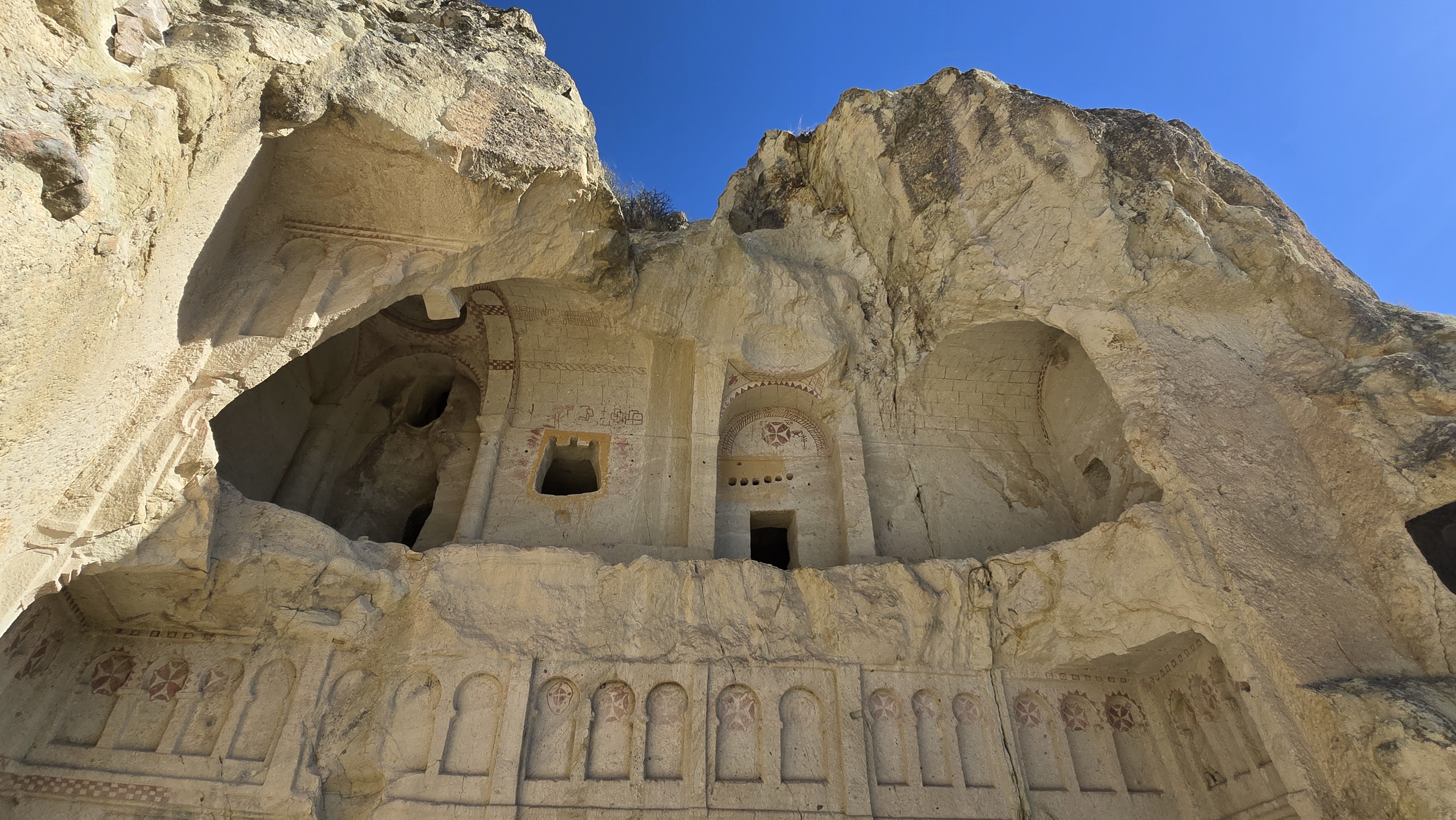
The church located on the second floor features a single-nave main corridor and a semicircular sanctuary area with two apses [2]. In front of the apses stands a baptismal font, while stone benches carved into the rock line the walls for the congregation to sit [2]. The names of the deceased inscribed in the graveyard immediately adjoining the church reinforce the view that clerics were interred here [2].
The third floor serves as the city’s strategic level, housing the most intensive production and communal living spaces [2]. This level contains vast food storage areas, kitchens, wine or oil presses, and winemaking facilities [2]. Additionally, the third floor features an andesite block, a type of volcanic rock utilized in cold copper metallurgy [2].
The andesite rock in question was not brought from outside, but carved directly from the local volcanic lava layer exposed during excavation [1]. This relief-textured stone features fifty-seven indentations bored into it to shape copper ore through hammering [2]. The copper processed within these hollows, which measure approximately ten centimeters in diameter, is believed to have originated from the mine located between Aksaray and Nevşehir [2].
The fourth floor accessible to visitors is reached with difficulty through a very narrow and low corridor [1]. This final accessible level features numerous storage facilities, kitchen quarters, and recesses carved for holding earthen storage jars [2]. The vast scale of these provisions areas attests to the settlement’s economic stability and its capacity to sustain a large population [2].
As a security mechanism, there are six round rolling stone doors resembling millstones that seal the corridors [1]. Hewn from rock
References
- [1] “Kaymaklı Yeraltı Şehri - Vikipedi”, https://tr.wikipedia.org/wiki/Kaymakl%C4%B1_Yeralt%C4%B1_%C5%9Eehri
- [2] “Kaymakli underground city - Wikipedia”, https://en.wikipedia.org/wiki/Kaymakli_Underground_City
- [3] “ANTİK BİR YERALTI ŞEHRİNDE AKUSTİK VE İŞİTSEL DENEYİM: DERİNKUYU YERALTI ŞEHRİ — Sezin NAS, Saadet Aytıs, Konca Şaher (2025, Nişantaşı üniversitesi sosyal bi”, https://dergipark.org.tr/tr/download/article-file/5158056
- [4] “YERALTI MİMARİSİNDE TİPOLOJİK SINIFLANDIRMA VE YAPAY ZEKÂ DESTEKLİ MEKÂNSAL TEMSİL: DERİNKUYU YERALTI ŞEHRİ ÖRNEĞİ — Sezin NAS, Saadet Aytıs (2026, DergiPark (I”, https://dergipark.org.tr/en/download/article-file/6230875
Konum
Harita: © OpenStreetMap katkıcıları. Haritada büyüt · Google Haritalar · Apple Haritalar
İşaret yaklaşık konumu gösterir; kesin konum için yerel kaynaklara bakın.
This article is compiled from scholarly monographs and official architectural inventories. Please verify site access conditions, visiting hours, and ongoing conservation status via official heritage authorities prior to visiting.