
Publication Date: October 2026
Overview
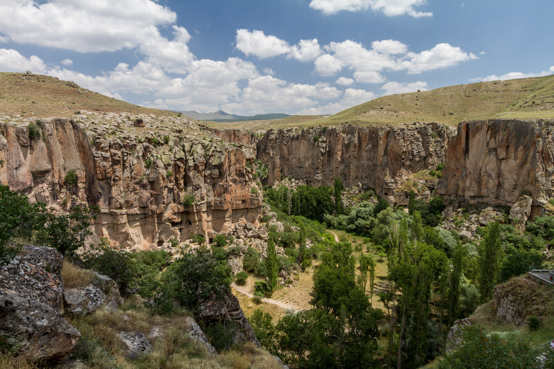
- What: A deep canyon valley carved through tuff layers deposited by the Mount Hasan (Hasandağı) volcano via the erosion of the Melendiz Stream [1].
- Where: Located in the Central Anatolia Region, within the Güzelyurt district of Aksaray province, stretching between the towns of Ihlara and Selime [1].
- Why it matters: The valley harbors roughly fifty rock-hewn churches, hermitages and shelters, and historical epigraphs dating back to the Seljuk era [2].
Ihlara Valley is a distinctive landscape where natural processes and human labor have progressed side by side across millennia [4]. The Melendiz Stream flows along the valley floor [1]. This watercourse has forged its way through precipitous rocky slopes by carving out meanders—sinuous curves [1]. The sheer cliff faces rising along the valley hosted innumerable living quarters carved into the stone over past centuries [1]. Concurrently, numerous places of worship were hollowed out directly within these walls [1].
It is recorded that the region was utilized as a secure haven from the earliest eras of Christianity onward [4]. In tandem with this, it served as a retreat for seclusion, monastic contemplation, and worship [4]. These structures hewn from the living rock harmonized the natural shelter of the terrain directly with the spiritual world of faith [4].
Today, descending to the valley floor reveals the canyon bed sculpted by the stream alongside the historic rock-cut sanctuaries [1]. In the following sections, all historical, architectural, and geographical specifics documented in written records can be examined step by step [1].
Where is it?
Ihlara Valley is situated within the administrative boundaries of the Güzelyurt district of Aksaray province in Turkey’s Central Anatolia Region [1]. The town of Ihlara marks the head of the valley [1]. The distance between this township and the district center of Güzelyurt is cited in the records as 15 kilometers [1].
The average elevation of the valley above sea level, calculated on the basis of the town of Ihlara, is measured at 1,276 meters [1]. According to census data, a total of 2,289 people reside in the township of Ihlara [1]. The geographical coordinates of the canyon valley are recorded as 38 degrees North latitude and 34 degrees East longitude [1].
Minor discrepancies appear across sources regarding the canyon’s precise length [2]. Turkish sources state that the canyon is 14 kilometers long [2]. International sources, however, cite this length as 15 kilometers [2]. The depth of the canyon valley likewise varies along its course [1]. This depth begins at 100 meters and reaches up to 150 meters in certain sections [1].
The valley commences at the town of Ihlara in the southeast [2]. It terminates at the town of Selime, situated to the northwest [2]. As the Melendiz Stream courses along the valley floor, it traces more than 26 natural S-shaped meanders between Ihlara and Selime [1]. These bends extend the total distance [1]. While the straight-line aerial distance between the two points is 8 kilometers [1], the actual flowing course of the river reaches 13 kilometers due to these windings [1].
In the middle of the valley, at a point situated between the towns of Ihlara and Selime, lies the village of Belisırma [2]. The historical Greek name of Belisırma village is Peristrema [2]. This term translates to “turn” or “bend” [2]. Over time, this name was also conferred upon the entire valley [2].
History & Origins
The genesis of the valley began in prehistoric epochs when the river incised through layers of volcanic tuff erupted by Mount Hasan [1]. Over millions of years of fluvial erosion, the Melendiz Stream sculpted the canyon [1]. In antiquity, this watercourse was known by the name “Potamus Kapadukus” [1]. The designation Potamus Kapadukus literally translates in ancient tongues to the “Cappadocian River” [1].
Human settlement activity within the valley gained momentum in the seventh century AD [2]. During this era, Byzantine monks arrived in the territory and began excavating the rock faces [2]. By carving into the soft volcanic tuff, the monks fashioned living shelters for themselves [2]. Furthermore, by erecting monasteries and liturgical buildings, they established organized monastic communities throughout the valley [2].
The painting and ornamentation of the regional churches began in the sixth century [1]. This decorative activity continued without interruption through the close of the thirteenth century [1]. According to historical sources, a decisive political development occurred in the mid-tenth century [1]. The Byzantine administration regained control over the Taurus Mountains and Cilicia [1]. Following this expansion, the construction of new churches commenced in the Ihlara area [1]. Architectural endeavors in the region experienced a marked resurgence during this phase [1].
In the eleventh century, the Seljuk Turks arrived in the area [1]. With the advent of the Seljuks, the practice of executing new wall paintings in the Byzantine manner came to an end [1]. Nevertheless, Christian religious life within the valley was not severed under Seljuk dominion [1]. This spiritual life persisted uninterrupted in the same fashion [1]. Historical records indicate that active ecclesiastical life in the area endured up to the onset of the twentieth century, specifically until 1924 [1].
The most tangible testament to Seljuk tolerance in the region is preserved in the village of Belisırma [1]. This evidence is found in the Church of Saint George [1]. The monument is colloquially designated the Kırkdamaltı Church [1]. A dedicatory inscription inside this sanctuary bears the names of the Seljuk Sultan Mesud II and the Byzantine Emperor Andronikos II inscribed side by side [1]. Dating to the thirteenth century, this epigraph clearly attests to the religious tolerance and latitude granted to diverse communities under Seljuk governance [1].
Architectural Form
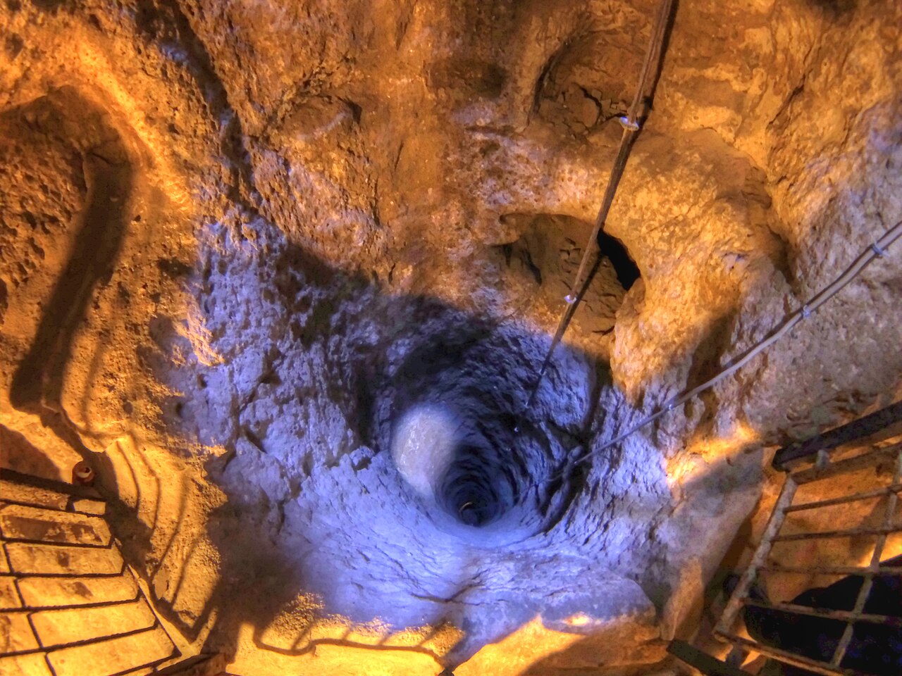
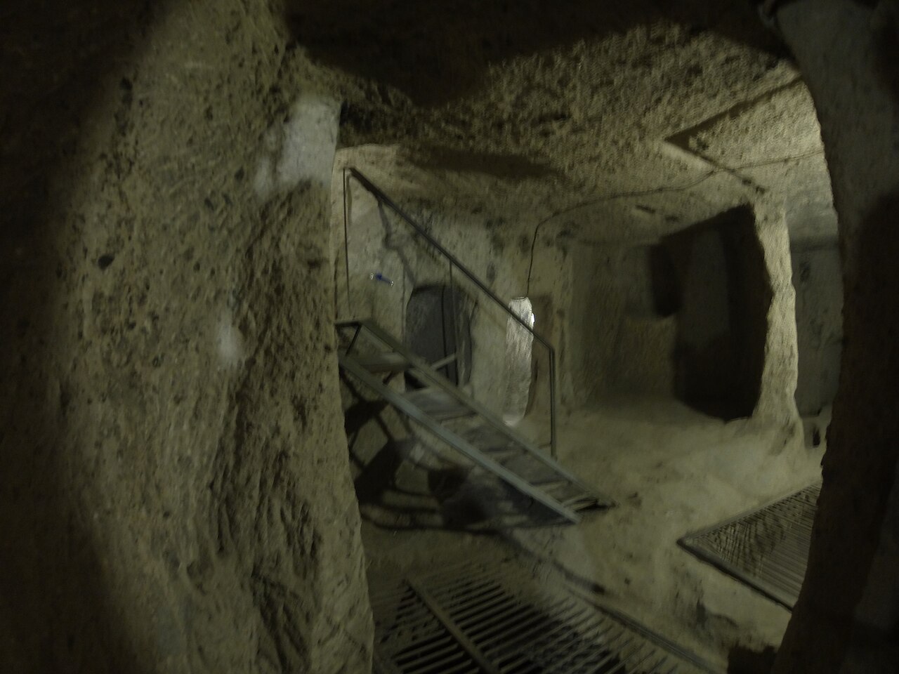
Ihlara Valley is defined by roughly fifty Christian rock-cut churches hollowed out from the sheer cliff sides of the canyon [2]. Alongside these religious monuments, a substantial number of rock-cut residential dwellings populate the valley [2]. The tuff stone in these rocky formations is soft, as it is composed of consolidated volcanic ash [1]. This lithic property allowed spaces to be carved with relative ease [1]. Furthermore, subterranean complexes could be interconnected via tunneled networks reminiscent of underground cities [1]. From the perspective of art history, the valley’s churches are systematically examined under two distinct principal groupings [1].
Churches Near the Village of Ihlara
The churches comprising the first group are located in the southeastern sector of the valley [2]. These monuments consist of rock-cut sanctuaries situated near the village of Ihlara [2]. The wall paintings within these shrines reflect the local “Cappadocian style” [2]. The Cappadocian style refers to an indigenous regional idiom displaying the visual hallmarks of Eastern, Iranian, and Syrian artistic traditions rather than the metropolitan styles of the Byzantine capital [2].
A substantial portion of these murals dates to the pre-Iconoclastic era [2]. Iconoclasm was a phase of theological turmoil within the Byzantine world lasting between 726 and 843 [2]. Throughout this era, the depiction of holy personages, portraits of saints, and sacred icons inside sanctuaries was banned, and pre-existing imagery was vandalized, effaced, or removed [2]. The designation pre-Iconoclastic thus identifies the era prior to 726, when these proscriptions were first introduced [2].
The Ağaçaltı Church, additionally referred to as the Church of Daniel Pantonassa, is a prominent rock-cut monument [2]. The church was excavated according to an inscribed (cross-in-square) Greek cross plan [2]. This configuration denotes an arrangement where a central square bay expands into four cross arms of equal length [2]. Presumed to have been dedicated to Daniel the Stylite, the church features a mural across its dome [2]. This painting depicts the Ascension of Christ [2]. The composition in question is dated to the pre-Iconoclastic period [2].
Yılanlı Kilise (The Snake Church), or the Church of the Apocalypse, is another noteworthy cruciform monument of the Ihlara cluster [2]. This edifice features an unusually elongated apse [2]. The apse constitutes the most sacred sector of the sanctuary—a semicircular or vaulted altar niche wherein priests celebrate liturgical rites and where the altar table is positioned [2]. The altar niche signifies a deep recess cut into the wall facing the liturgical orientation [2].
Depictions of the Last Judgment and the torments of hell adorn the structure’s narthex [2]. The narthex is the vestibule or entrance hall crossed before accessing the primary liturgical space of a church [2]. Beneath these compositions appear four nude sinners constricted and enveloped by serpent-like monsters [2]. The church derives its colloquial name directly from this iconographic motif [2].
Pürenli Seki Kilisesi represents an extensive sanctuary complex comprising four separate chambers carved into the rock [2]. The murals in the church include a composition of the Crucifixion of Christ [2]. In addition, depictions of saints and figures on horseback are present [2].
The paintings preserved in this structure were executed using the “fresco” technique [2]. A fresco is a durable wall painting executed by applying pigments ground in water directly onto the wet, fresh lime plaster of the wall surface [2]. As the plaster sets, the pigment integrates chemically into the matrix, producing a long-lasting surface [2]. The frescoes in this sanctuary are dated by art historians to between the second half of the ninth century and the eleventh century [2].
Kokar Kilise is known as a structure dedicated to the Apostle Andrew [2]. Eğritaş Kilisesi stands among the most ancient and expansive monuments in the valley [2]. It is specifically documented in historical sources that the murals of Eğritaş Kilisesi were likewise executed prior to the Iconoclastic crisis, antedating the year 726 [2].
Around Belisırma and Byzantine Era Churches
The second church cluster is centered around the village of Belisırma in the central stretch of the valley [2]. The monuments in this group manifest the stylistic hallmarks of “Macedonian art” [2]. Macedonian art encompasses the classical Byzantine aesthetic that flourished under the Macedonian dynasty across the tenth and eleventh centuries [2]. This style gives prominence to a more harmonious, classicizing court aesthetic originating from the imperial capital of Constantinople [2].
Direkli Kilise (Pillared Church) is a structure centered on a cruciform nave [2]. In ecclesiastical architecture, the nave designates the primary longitudinal vessel and processional hall extending from the entry portal toward the altar [2]. The church was hewn from the living rock during the tenth century [2]. The central dome of the sanctuary is carried by four monumental rock-cut columns [2]. These columns are ornamented with portraits of saints [2]. An inscription inside the church explicitly attests that the monument was dedicated during the reign of the Byzantine Emperor Basil II [2].
Sümbüllü Kilise (Hyacinth Church) exhibits a T-shaped ground plan [2]. A T-shaped ground plan defines an arrangement that resembles the letter “T” when viewed from above [2]. In this design, a transverse entrance hall or ante-room intersects at right angles with the primary liturgical hall, generating the “T” contour [2]. Through this architectural layout, the church embodies the transitional stage into Macedonian art [2]. Its wall paintings portray Emperor Constantine VII alongside his consort Helena [2]. On the exterior facade, however, Eastern architectural influences have been retained [2].
Within the environs of Belisırma, there are also major monuments including Ala Kilise, Karagedik Kilisesi, and Bahaeddin Samanlığı Kilisesi [1]. Karanlık Kale Kilisesi (Dark Castle Church), excavated into the cliffside as a monastic church, is likewise affiliated with this group [2]. This building stands apart from the surrounding ornamented sanctuaries due to its austere architecture, entirely devoid of wall paintings [2].
Burial Sites and Funerary Traditions in the Churches
The rock-cut churches of Ihlara and Belisırma did not function exclusively for liturgical services [3]. These spaces were simultaneously utilized extensively as Christian funerary and burial sites [3]. The entrance halls of the churches, known as narthexes, were excavated to accommodate burials [3]. The side aisles constituting the lateral corridors and the floor pavements were similarly utilized for this purpose [3].
The sanctuaries house tombs termed arcosolia [3]. An arcosolium refers to an arched burial niche hollowed directly into the rock face [3]. Alongside these, self-contained funerary chapels and dedicated burial chambers abutting the central church spaces are also present [3]. Furthermore, numerous shaft and floor graves carved into the paving of the naos have been identified [3]. The naos represents the main domed hall of a church where the congregation gathers for worship [3].
The patrons of these tombs projected their hopes for post-mortem intercessory prayers upon the walls [3]. They expressed these hopes through donor portraits and epigraphs commissioned upon the interior surfaces [3]. A “donor” (ktetor or bani) is a beneficent patron who finances the construction of an edifice, the excavation of a rock church, or the costs of mural ornamentation through private resources [3].
Donor portraits are artistic representations in which the patrons funding these undertakings had their own likenesses painted onto the walls [3]. By including inscriptions beneath their likenesses, these figures sought to elicit prayers on their behalf from congregants visiting the church [3]. These sepulchral spaces demonstrate that the funerary customs of the Byzantine imperial capital were perpetuated with slight local adaptations inside an Anatolian provincial valley [3].
Visiting Notes
Descent into Ihlara Valley is undertaken via the flight of steps situated at the northern periphery of the town of Ihlara [2]. At this location, a steep stone stairway consisting of approximately 400 steps is used to descend to the canyon floor [2]. This staircase carries visitors down to a depth exceeding 100 meters [2]. The valley floor is reached at the bottom of these steps [2].
The walking route stretching through the valley from Ihlara to Selime extends along a 13-kilometer corridor following the course of the stream [1]. According to sources, visitors can traverse rock paths inside the valley [1]. In addition, crossing points situated alongside the river meanders can be utilized for hiking [1].
Current opening and closing hours, as well as public holiday arrangements, are not detailed in these sources [1]. Public transportation options are not explicitly specified in the source texts [1]. Nor is written information provided regarding parking facilities or on-site guided services [1]. Consequently, these practical operational details should be verified with official administrative authorities before arranging a visit [1].
Ihlara Valley remains a multi-tiered cultural landscape that fuses nature’s millions of years of geological handiwork with the spiritual heritage of mankind [4]. While navigating the valley, it is essential to consider the presence of the churches hollowed out from the rock [4]. In the same vein, apprehending the historical context of the frescoes applied onto wet lime plaster and the funerary niches will provide greater depth to the journey [4].
References
- [1] “Ihlara, Güzelyurt - Vikipedi”, https://tr.wikipedia.org/wiki/Ihlara_Vadisi
- [2] “Ihlara valley - Wikipedia”, https://en.wikipedia.org/wiki/Ihlara_Valley
- [3] “IHLARA VADİSİ, IHLARA VE BELİSIRMA KAYA KİLİSELERİNİN GÖMÜ ALANI OLARAK KULLANIMI — Hülya Coşgunaras (2023, Sosyolojik Düşün)”, https://doi.org/10.37991/sosdus.1401474
- [4] “KÜLTÜREL COĞRAFYA BAĞLAMINDA BİR ANALİZ ÇALIŞMASI: IHLARA VADİSİ KÜLTÜREL PEYZAJI — Elif KAHYA (2023, the Journal of Academic Social Sciences)”, https://asosjournal.com/files/asosjournalmakaleler/3e5fc520-f7f7-424f-9715-53d9f738dc7c.pdf
Konum
Harita: © OpenStreetMap katkıcıları. Haritada büyüt · Google Haritalar · Apple Haritalar
İşaret yaklaşık konumu gösterir; kesin konum için yerel kaynaklara bakın.
This article is compiled from scholarly monographs and official architectural inventories. Please verify site access conditions, visiting hours, and ongoing conservation status via official heritage authorities prior to visiting.