
October 2026
Overview
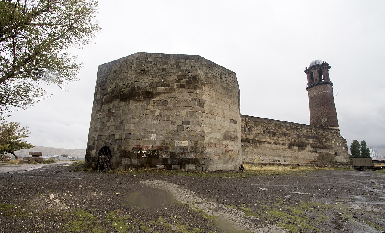
- What: A historic monument situated within Erzurum Castle, also known as the Clock Tower (Saat Kulesi) or Tepsi Minaret (Tepsi Minare) [1].
- Where: Located within the boundaries of the Kale Quarter in the Yakutiye district of Erzurum Province, in Turkey’s Eastern Anatolia Region [4].
- Why it matters: Regarded as the city’s oldest monument, featuring ramparts dating back to the fifth century and a brick minaret reflecting Central Asian architecture [3].
Situated in the traditional center of Erzurum, Erzurum Castle stands as the city’s oldest monumental precinct [3]. Historical sources identify this defensive area as a registered cultural heritage site bearing the assembled traces of different eras [3]. Rising within the inner citadel, the Tepsi Minaret has formed part of the region’s skyline for roughly nine centuries [5].
Originally constructed as the minaret of a castle masjid (small mosque), the structure assumed new roles across the centuries [4]. Converted into a watchtower to meet defensive requirements, it later acquired the identity of a “Clock Tower” following the installation of a clock at its summit [4]. Today, this architectural ensemble serves as a cultural heritage documenting the historical richness of Eastern Anatolia [4].
Historically, the fortress grounds were a vibrant junction where military units guarding the eastern frontier met international trade routes (major commercial arteries) [6]. Historical sources emphasize that the castle evolved in close harmony with local civilian life while simultaneously ensuring the city’s strategic security [3].
Where is it?
Erzurum Castle is located within the borders of the Kale Quarter in Yakutiye, the central district of the city of Erzurum in Eastern Anatolia [4]. Rather than citing numerical coordinates, it can be stated that the castle occupies the heart of Erzurum’s city center, in close proximity to the historic bazaar. The Tepsi Minaret, situated in the inner citadel, rises within the fortress at the very same location [1].
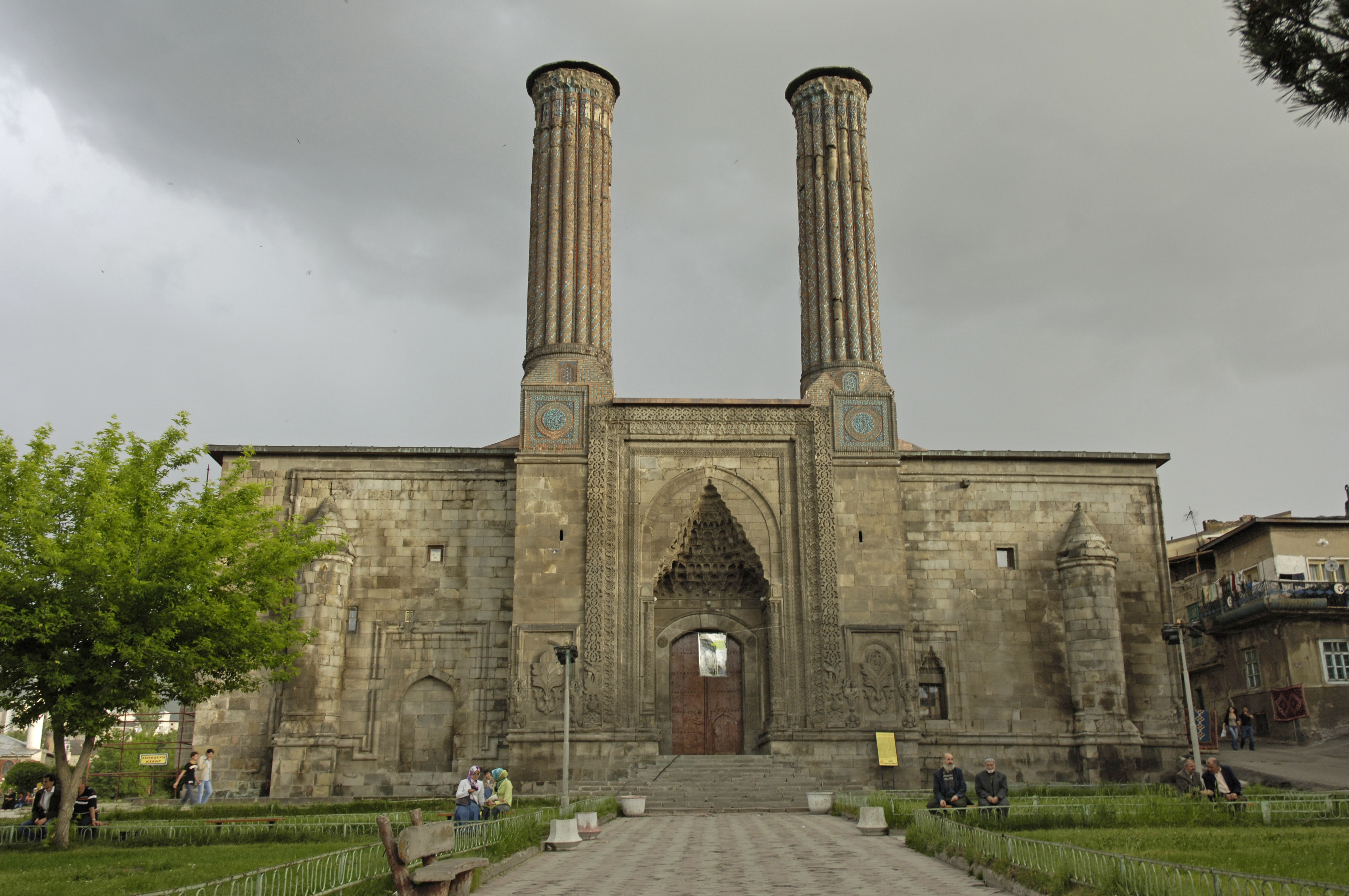
The historic castle grounds stand adjacent to another celebrated cultural asset of the city, the Çifte Minareli Medrese [3]. Erzurum was established at the crossroads of ancient trade routes reaching from Central Asia and the Caucasus to the Mediterranean and the Black Sea [5]. Throughout history, these major commercial routes turned the city into a focal point of political, mercantile, and military rivalry among diverse states [6].
As a frontier fortress (serhat castle) on Anatolia’s eastern boundary, Erzurum Castle was continuously reinforced against external threats across centuries [6]. In the 18th century, the castle functioned as an essential logistical center where military munitions dispatched from Istanbul to the eastern frontier were assembled [6]. By the 19th century, the castle’s perimeter became encircled by shops and dwellings, integrating into the city’s social fabric [3]. Today, the castle is frequented by both domestic and foreign visitors [4].
History & Origins
According to historical sources, the construction history of Erzurum Castle dates back to the Byzantine Empire in the 5th century [3]. The Byzantines erected the initial fortress at this location in 422 CE amid ongoing military conflicts with the Persians [3]. This early defensive structure laid the foundation for the city’s urban development and military planning in subsequent centuries [3].
Following the Battle of Malazgirt, the Great Seljuk Sultan Alp Arslan commissioned his commanders with the conquest and development of Anatolia [5]. During this period, Abu’l-Qasim Izz al-Din Saltuk Bey selected Erzurum as his capital, establishing the Saltukid Principality in the region [5]. The Saltukid administration launched a swift urban development campaign in their capital at this strategic crossroads [5]. In the 12th century, the Saltukids introduced major structural modifications to the former Byzantine fortress, reorganizing the ramparts [3].
Situated in the interior of the fortress, the Tepsi Minaret was commissioned between 1124 and 1132 by a Saltukid ruler [1]. While one source records this sovereign as “Abu’l-Muzaffer Gazi”, another designates him as “Abu’l-Muzaffer Gazi Inanch Bey” [4]. In subsequent passages of the same text, the name is expanded to “Abu’l-Muzaffer Gazi Inanch Biygu Alp Tughrul Bey”; here, his full name can be explained as “Inanch Biygu Alp Tughrul Bey” [4]. When first built, the minaret functioned to broadcast the call to prayer for the inner citadel’s masjid (small mosque) [4]. Over time, it evolved into a watchtower where sentries kept vigil for the defense of the city [4].
During the Ottoman era, the fortress was garrisoned by the kapıkulu (Janissary) military class serving the sultan [3]. An 18th-century mevacib defteri (military personnel and payroll register) provides valuable documentation regarding the troop numbers and daily stipends of the military classes stationed at the fortress [6]. Particularly during the Ottoman–Safavid wars in the first half of the 18th century, both the number of troops dispatched to the castle and the volume of distributed munitions rose [6]. Military ordnance arriving from Istanbul was transferred onward to fortresses such as Tabriz, Revan (today Yerevan, Armenia), Tiflis (today Tbilisi, Georgia), Kars, Van, and Ahıska (today the Lower Karabakh region) [6]. Official repair registers from the period preserve accounts of the ramparts, bastions, building materials, and maintenance expenditures [6].
With the addition of a mechanical clock to the minaret, the edifice came to be popularly known as the “Clock Tower” [4]. Although the exact date the timepiece was installed atop the tower is not known with certainty, its addition prior to 1843 is documented [1]. Certain sources record that the clock was fitted to the summit of the minaret in the early 19th century [4]. The structure has also been referred to by various names, such as “Kesik Kule” (Cut Tower), “Top Kulesi” (Cannon Tower), and “Minare Kule” (Minaret Tower); however, the original name best reflecting historical and scholarly accuracy is “Tepsi Minare” [4].
During the 19th-century Ottoman–Russian wars, Erzurum’s defensive perimeters expanded well beyond the confines of the fortress [3]. Historian William Edward David Allen noted that there was no direct combat upon the ancient fortress walls when the Russian army entered the city [3]. Deep fissures in the weathered shaft of the minaret were investigated with seismic instruments by the Ministry of Culture and Tourism in 2018, leading to the implementation of a restoration project that safeguarded the monument’s authentic fabric [4].
Architectural Form
Erzurum Castle and the tower within showcase the defensive engineering and stonemasonry of disparate epochs [4]. Much of the surviving fortress walls is the product of 12th-century Saltukid-era architectural configurations [3]. The masjid located within the inner citadel possesses a distinctive architectural character, designed according to a plan that features no open central courtyard [3].
Rising as a freestanding structure, the Tepsi Minaret stands 30.75 meters tall [1]. Its construction combines ashlar (smooth, large stone blocks) with brick (small bricks manufactured from lime); this composite technique reflects both the aesthetic sensibilities and the available building methods of the era [4]. The monument’s load-bearing base is composed of ashlar blocks in three distinct colors at ground level [4].
Above the polychrome stone plinth, the cylindrical shaft is constructed in brick masonry and tapers gently toward the top [4]. The doorway providing access to the shaft features a straight lintel with a flat architrave (a decorative arrangement formed of horizontal stone blocks); the term “lintel stone” (atkı taşı) denotes a horizontal load-bearing stone block placed across openings such as doors or windows [4]. Directly above the portal sits a pointed-arched pediment / tympanum (alınlık, a triangular or arched decorative feature above an opening) [4].
The balcony at the upper section of the shaft, namely the şerefe (the parapeted gallery encircling the minaret), imparts both a religious and military identity to the structure [4]. The şerefe served as an area from which the muezzin proclaimed the call to prayer and sentries conducted surveillance [4]. The architectural characteristics of the minaret are regarded as a singular Anatolian continuation of the Central Asian brick minaret tradition [5]. Despite the ravages of time, scholars compare the authentic architecture of the surviving şerefe section with Central Asian precedents [5]. The slender cylindrical profile and elevated height contributed directly to the fortress’s defense [4].
The clock installed atop the Tepsi Minaret in the 19th century harmonizes with the brickwork to produce a distinctive silhouette [3]. Architectural lighting systems installed in recent years enhance the monument’s visual presence during evening hours [4]. Erzurum Castle is among the limited number of fortresses in Turkey to have been modeled in three dimensions utilizing virtual reality (VR) technology [3]. In addition, a scale model of the tower is exhibited in the “Clock Towers: Witnesses of Time” park, inaugurated in the Safranbolu district of Karabük in 2012 [1]. Architectural documentation regarding the tower is featured in catalog works by scholars such as Meltem Cansever and Hakkı Acun [1].
Visiting Notes
Erzurum Castle and the Tepsi Minaret form an accessible historical monument in the ancient Kale Quarter of the Yakutiye district [4]. The architectural complex constitutes a principal stop along historical walking routes and cultural city tours around Erzurum Castle [4]. Restorations and perimeter illumination carried out around the tower ensure that the monument can be viewed clearly and safely from the outside [4].
Before planning your visit, consulting official websites or local tourism offices is recommended [4].
References
[1] Tepsi Minare - Wikipedia
ADDRESS: https://tr.wikipedia.org/wiki/Erzurum_Saat_Kulesi
[2]
Konum
Harita: © OpenStreetMap katkıcıları. Haritada büyüt · Google Haritalar · Apple Haritalar
İşaret yaklaşık konumu gösterir; kesin konum için yerel kaynaklara bakın.
This article is compiled from scholarly monographs and official architectural inventories. Please verify site access conditions, visiting hours, and ongoing conservation status via official heritage authorities prior to visiting.